
Deepwater Concepts
What’s in the app
Interactive Pro map: Every mark, every break, one live chart
Interactive Pro map

Every mark, every break, one live chart

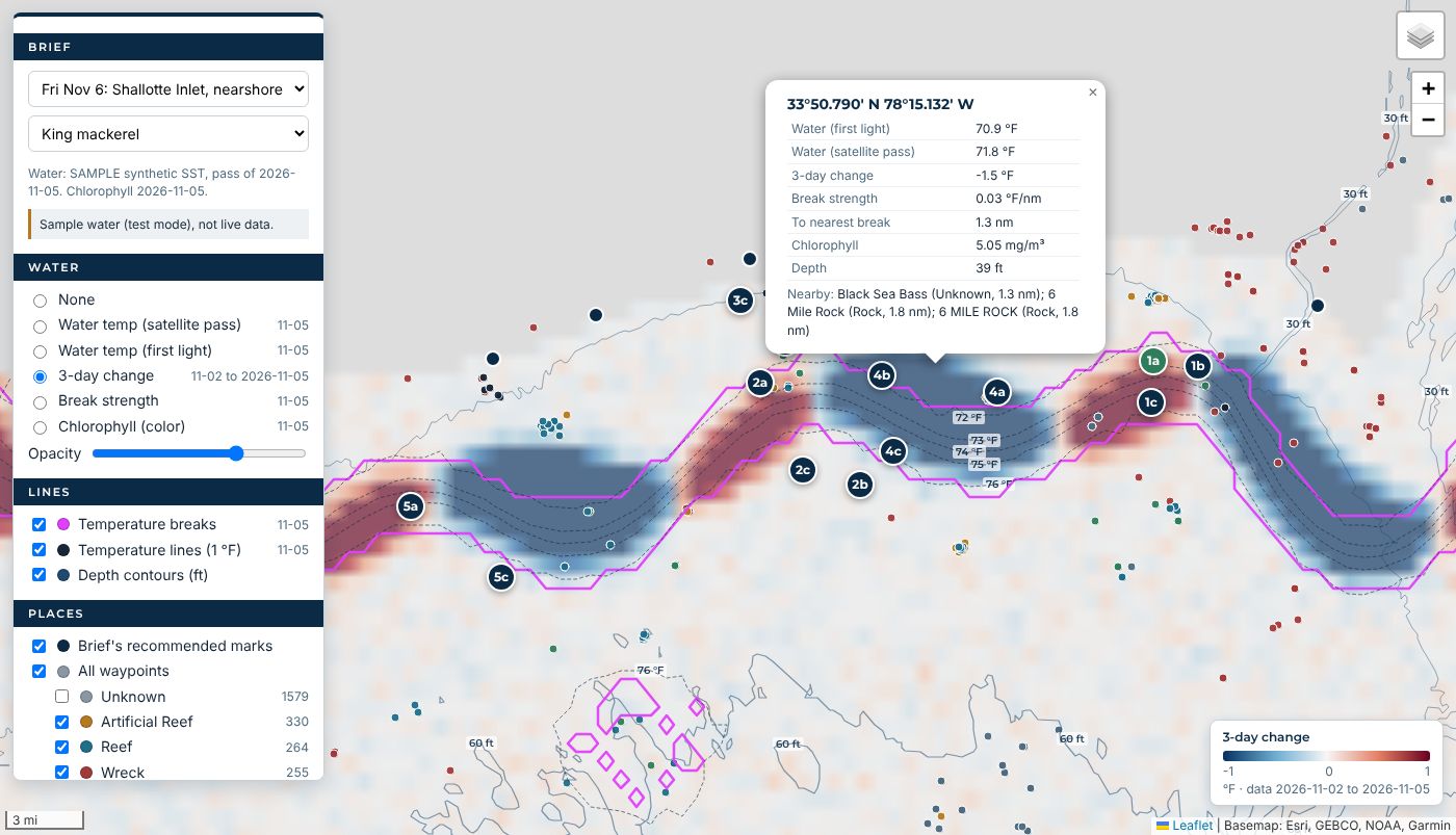
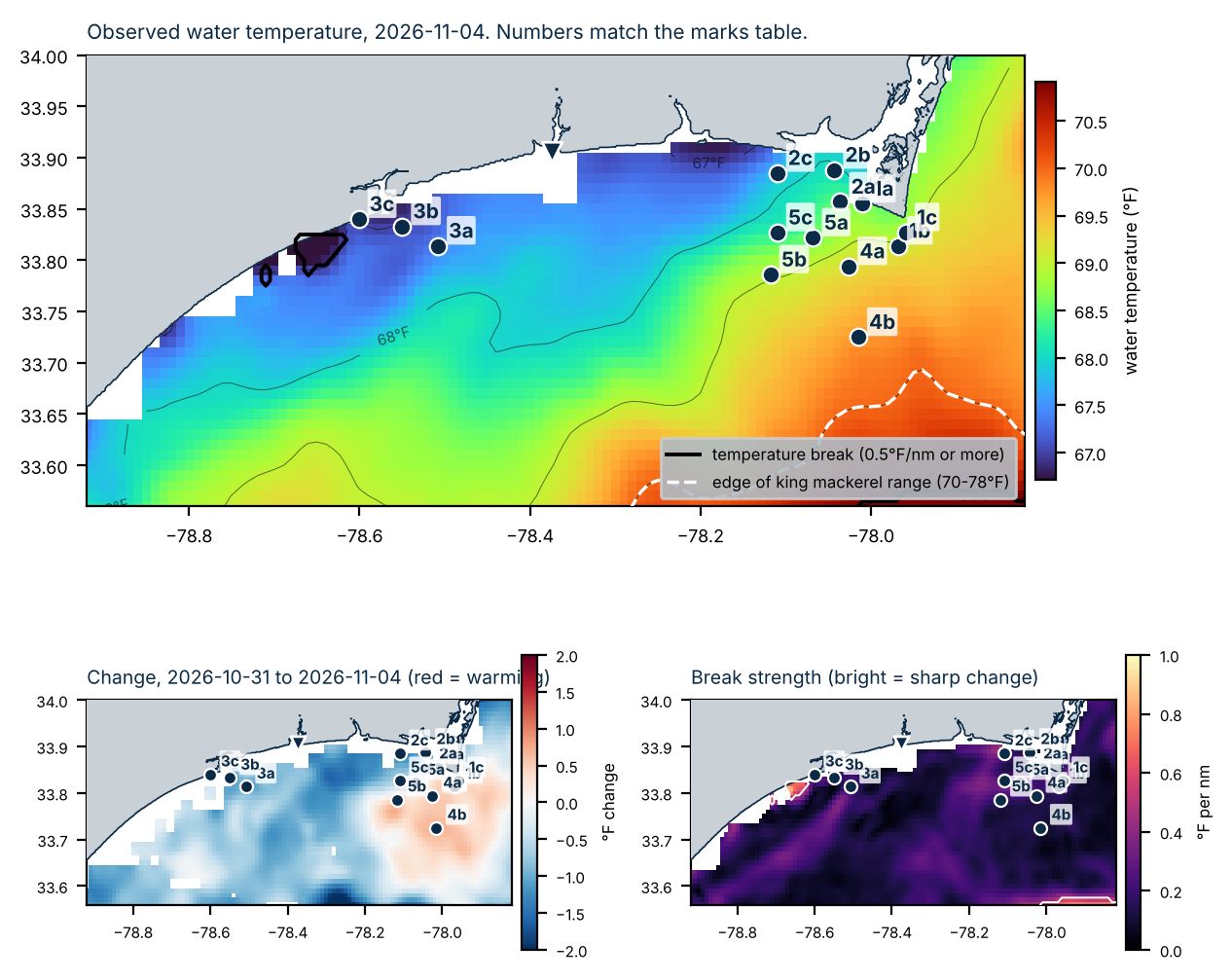
Tap anywhere on the water for temperature, 3-day change, break strength, chlorophyll, depth and the nearest structure. Wrecks, reefs, ledges and artificial reefs are all on the chart with your brief's marks on top.

Data layers: More water data than one satellite can see
Data layers

More water data than one satellite can see

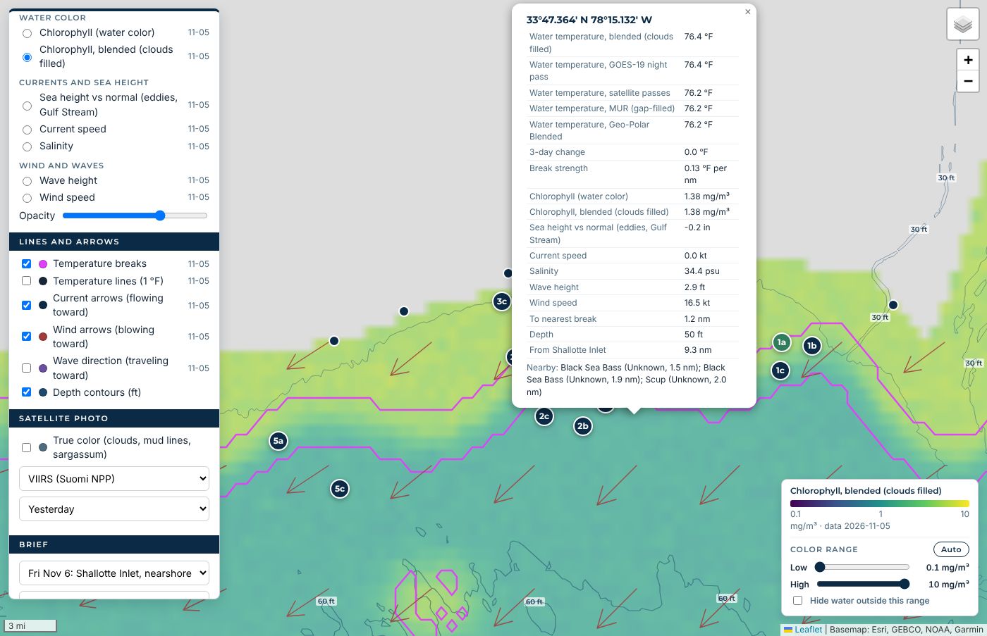
Water temperature from GOES-19 night passes, VIIRS and AVHRR, MUR and Geo-Polar, plus chlorophyll, currents, sea height, salinity, wind and waves. Set your own color range to make an edge pop.

Blended views: Clouds don't stop the read
Blended views

Clouds don't stop the read

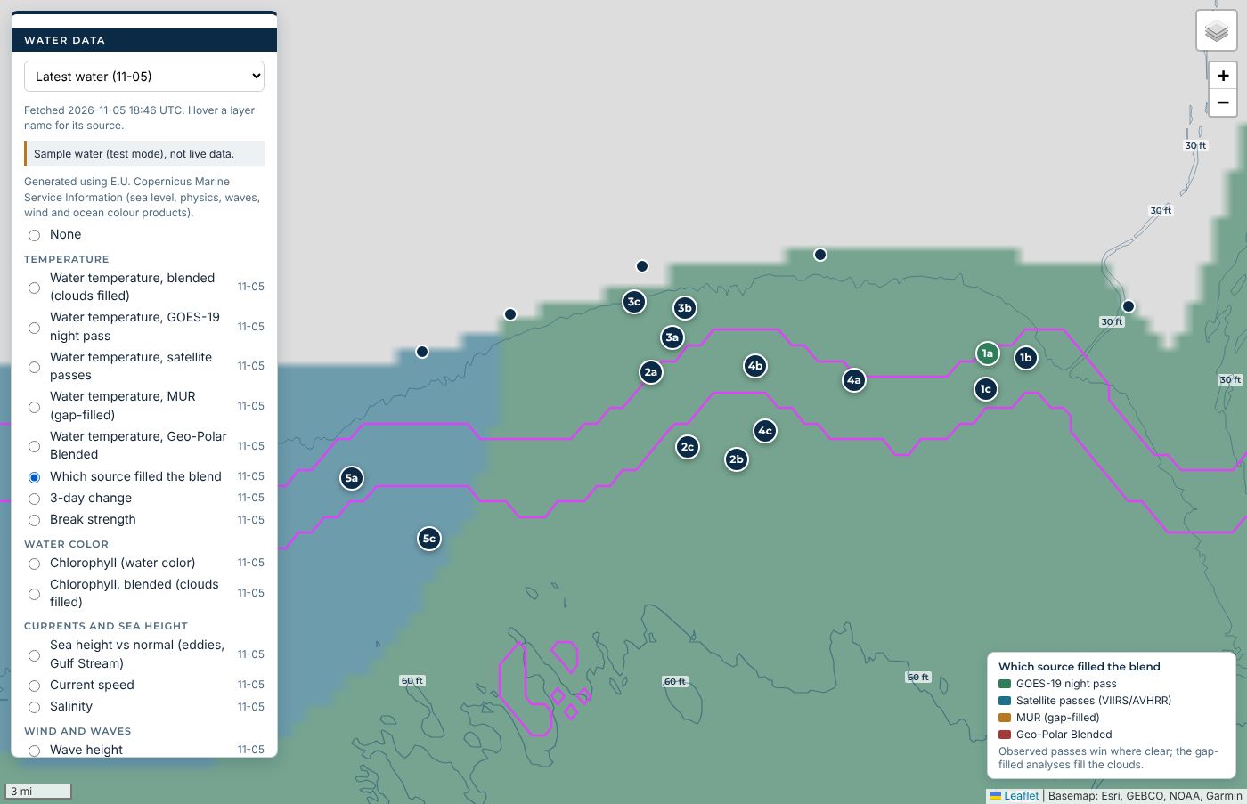
Clear satellite passes win, and the gap-filled analyses fill in under the clouds. The map shows you which source filled every patch of water, so you know what you're trusting.

Custom fishing briefs: Your inlet, your fish, your day
Custom fishing briefs

Your inlet, your fish, your day

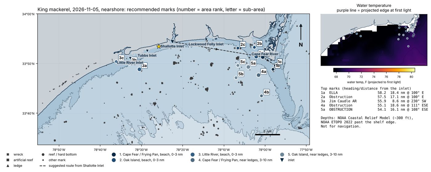
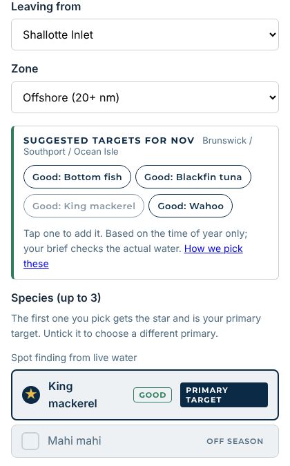
Pick an inlet, nearshore or offshore and up to three species. The brief ranks the marks worth your fuel, draws the run from your inlet and gives distance and heading to each one.

Temperature-break charts: See the edge before you burn the fuel
Temperature-break charts

See the edge before you burn the fuel

Every brief shows the water behind each pick: where the breaks are, how the water moved over 3 days and how sharp each edge is, with a table of temp, trend, distance to the break and depth for every mark.

Tides, moon and bite windows: Know when, not just where
Tides, moon and bite windows

Know when, not just where

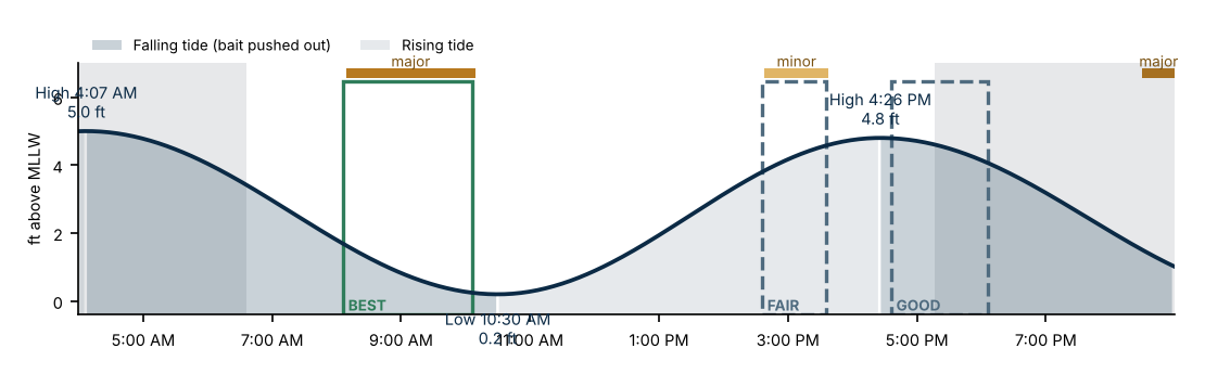
Falling tide at your inlet pushes bait out, and the brief lines it up with the moon's major and minor periods to mark the best, good and fair windows of the day.

Captain and pier reports: Reports, checked against the water
Captain and pier reports

Reports, checked against the water

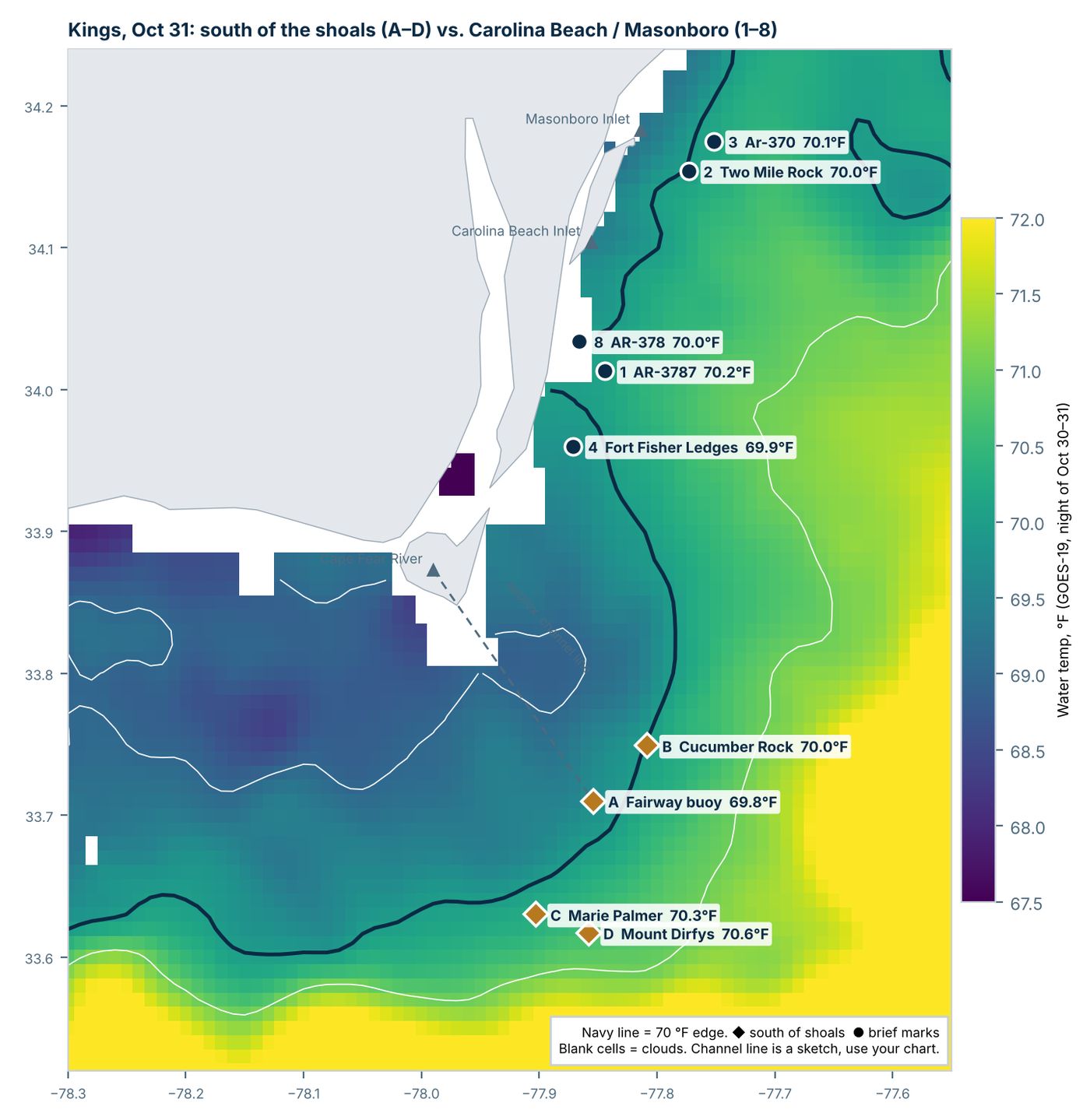
Recent captain, pier and forum reports are weighed against what the satellites actually show, so you're not running on hearsay. This chart checked two report areas against the 70 °F edge.

Built for the boat: On your phone, even with no signal
Built for the boat

On your phone, even with no signal

Seasonal target suggestions, a brief in a minute or two, and a Save offline button that keeps the whole brief on your phone for when the bars run out offshore. PDF download too.

Captain program: Run trips? Fish on us
Captain program

Run trips? Fish on us

Captains on this coast get full Pro free, free shares on our social media, and a tag and link to their charter on every post credited to them. All we ask is 4 trip reports a year.

Captains: apply

Know where to fish before you leave the dock

The Captain's Daily Brief reads this morning's satellite water, tides, moon and forecast, then ranks the spots worth your fuel for the fish you're after.

Sign upLog in
Captain? Get free Pro and free promotion: apply →

What you get

The best spots, ranked

Every mark scored on water temperature breaks, color edges, structure and run distance from your inlet, with the reasons behind each pick.

When to go

Falling tide at your inlet, moon phase and the best bite windows, in plain words.

Bait and tackle

What to put on the hook for each species this time of year.

Bottom fishing done right

Structure at the right depth for the species and season, with the right baits. No guessing from surface water.

Works offshore

Save any brief to your phone and open it with no signal, or download the PDF. Put the app on your phone.

Gets smarter with every trip

Log what worked and what didn't. Every trip, including the empty ones, sharpens the next brief.

How it works

  1. Pick your inlet and whether you're running nearshore or offshore.
  2. Choose up to three species, in order of priority.
  3. Get your brief in a minute or two, on your phone or computer.
  4. After the trip, log how each spot did.

Where it works

The pilot covers the southern NC and northern SC coast: Little River, Tubbs, Shallotte, Lockwood Folly and Cape Fear. More regions follow as captains join.

For captains

Captains: fish free and get promoted

Run trips on this coast? Join our team of captains.

All we ask: 4 trip reports a year and honest feedback on the briefs.

Captains: apply
This is an early test version. Accounts are approved by hand while we calibrate.